
As we get closer to another return to Eddington in Cambridge for Prospection, I realise I never mentioned what I did last year.
I have always shied away from making in my creative archaeology, I think because I’m worried that people will think I’m trying to make art and that it won’t be good art. But I’m a lot more confident in my creative archaeology now and happy that work that looks like bad art can still be good archaeology!
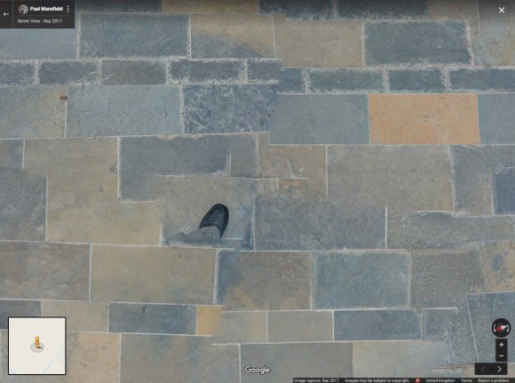
Before last year’s visit to Eddington I was amazed to see that on Google Maps, where Eddington still appears as a building site despite its many residents, there was a single panoramic photo in its central market square, taken on an open day. Panning around, I found a foot and some glitchy image mapping.
I decided that I would like to mark this first widely accessible digital incursion onto the site by creating an analogue copy for our archive.
Arriving at Eddington, I found the exact spot of Mansfield’s foot and set to work with a graphite stick and long rice paper scrolls, with invaluable help holding it all down from Yasuyuki Yoshida.
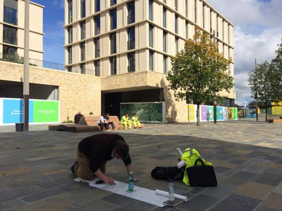
Completed in about 30 mins, the result is this c 1.5 x 1.5 m rubbing of Paul Mansfield’s Google Maps photo, ready to enter the Cambridge city archive as a record of that first publicly sourced, geo-located digital image of the site.

