
Looking at maps of Chester to see where I might walk, I became particularly interested in this patch of ground straddling the border between England and Wales.

In my call for ideas to use in investigating Chester, Lorna Richardson had suggested having a look at Boundary Road, along which the border runs, and I did a bit of that as well, but this bit of land intrigued me most as the actual location of the border was, on Google maps at least, very hard to pin down.


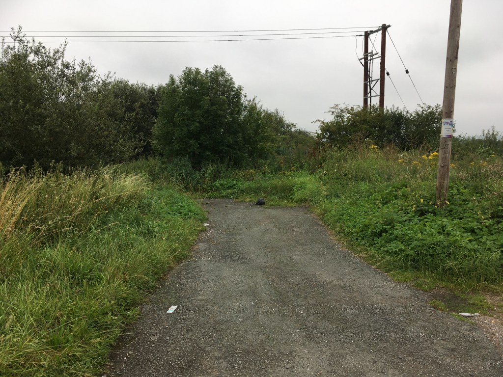
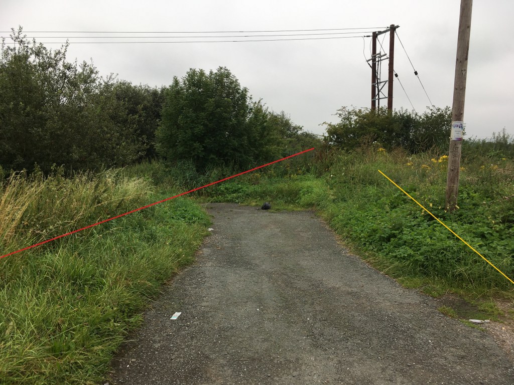
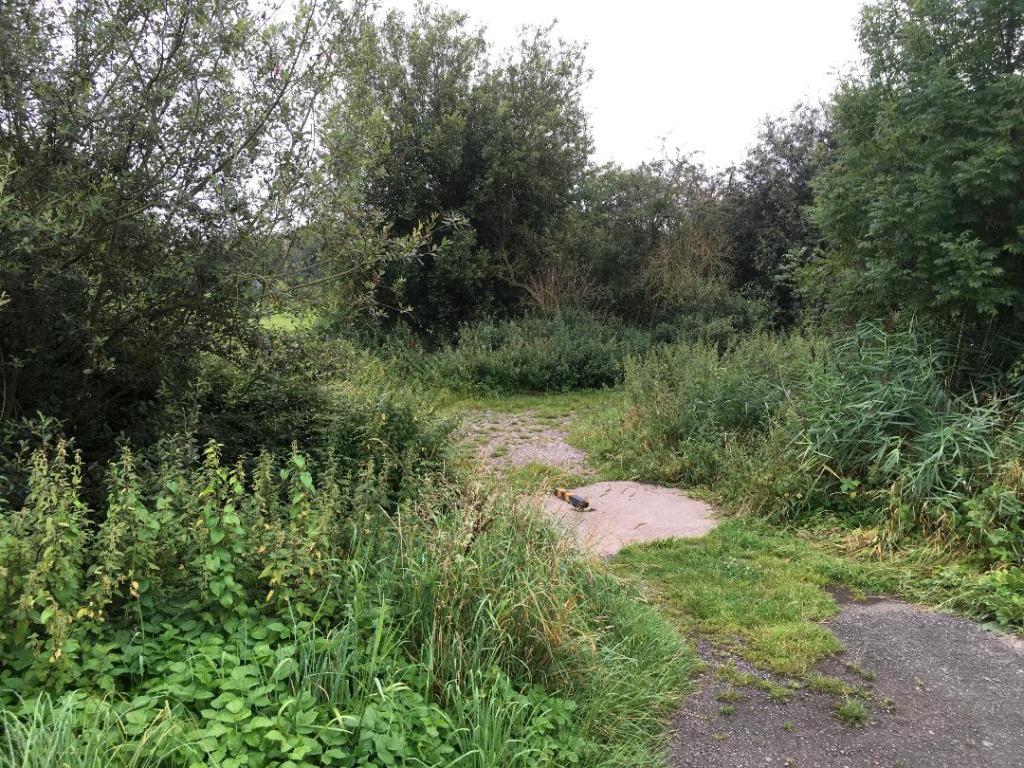
I love little spaces like this. Clearly the border is in there somewhere and must relate to geographical features, but how? Has it ever mattered that there is this little trackway that leaves the road and crosses the border through the fields?
Boundary Road is, as I say, part of the Wales-England border. It looks like this:
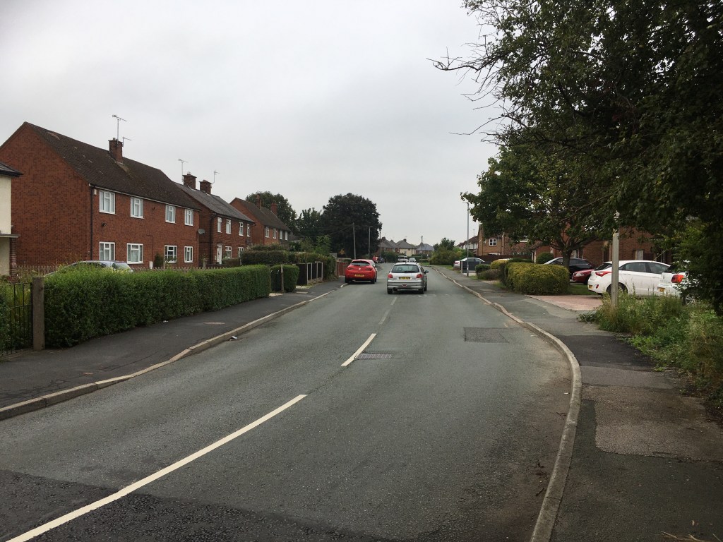
I was hoping to caption this image to say that the silver car had crossed the border to pass the red car, but the border actually runs along the pavement on the left of the photo, so the silver car has been in England the whole time (Wikipedia wrongly states that the border runs down the middle of the road). However the red car is parked with two of its wheels in a different country! Presumably the location of the border means that the road was here before the pavements, or at least the Welsh pavement which, interestingly, is in better condition than the English one.
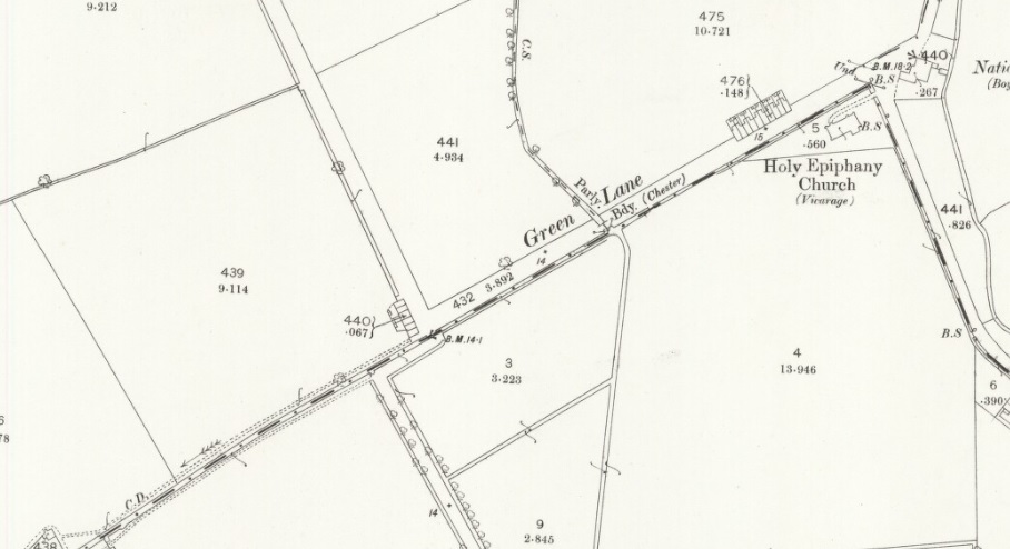
Looking at maps to work this space out, two things leapt out. The first is that Boundary Lane, so obviously named after the border that runs along it, is actually Foundary Lane, the location of Dee Iron Works and other industrial sites. Second, that the area I went out to look at is a mess of boundaries that I haven’t quite managed to unpick; the City of Chester boundary seems to be nearby as well as another parliamentary boundary and, of course, the border.


But we can also see here that that odd little space is literally underneath the border as shown on the map. Its dimensions seem to correlate to the thickness of the line. Doubtless just a coincidence. But also of interest is the trackway that leads at right angles off it, south-east into the fields. This trackway appears to still exist, but isn’t clearly visible from the road. At some point, this area has been part of an access route across the fields from Balderton into Saltney and beyond into Wales.
The 1883 and 1947 OS maps show the trackway just inside the English side of the border, while contemporary Google maps shows it in Wales. The latter might make most sense as it now runs along a ditch attached to Balderton Brook, a handy natural feature to refer to in the landscape.

So what’s going on? Well, there are three possibilities: 1) that either Google maps or the OS is wrong, 2) that the border has moved between 1947 and now, or 3) that the trackway on historic maps is actually adjacent to the one visible today, i.e. the layout of the site has changed.
I might find out one day. The border has been fixed since 1536 so my working hypothesis, without any real effort to check yet, is that the layout of the roads has changed and this trackway is what remains of the old Green Lane, kept here as access to the cross-field track to Balderton.

But, for now, I’m happy to leave it as an odd little spot between countries, and between past and present. It sparks joy in me to not know for sure either way and to imagine this little slab ‘bridge’ over the ditch as the border crossing between England and Wales.
I would love to find other, similar sites around Chester, sites whose identity is hard to decipher, for whatever reason. Do you know any?

2 replies on “Investigating Chester: Borderlands, 14 August 2020”
Yes, in Blacon, where Saughall Rd meets Saxon Way. Follow the curve of ‘old’ Saughall Rd round west and you will come across a track. I reckon this is an ancient track I’ve read about used by a king (Edward I?) and his men to a crossing point on the Dee, and from there into Wales.
Interesting! I’ll have to go and have a look next week…